One of the first things you’ll notice, as you begin planning for your Mt. Elbrus trip, are some pretty serious travel warnings. And not just to the greater North Caucasus region, but specifically referring to the drive to Mt. Elbrus.
What are you to make of all this? Is it as dangerous and risky as you’ve read? Should you postpone your trip until things “cool down”? Or do the travel warnings not line up with present-day reality in 2019?
Read further for a play-by-play of what happens from the moment you land at the Caucasus Mineral Waters airport (Mineralni Vodi – MRV) and are transferred to Mt. Elbrus.
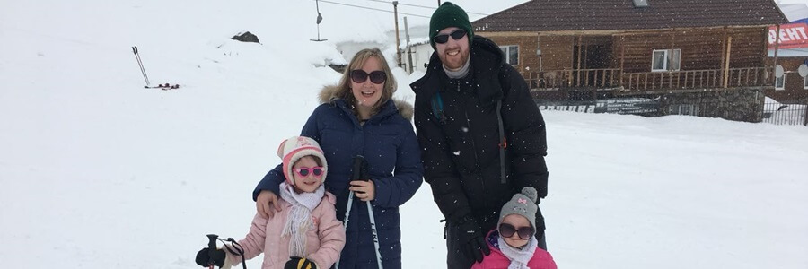
A little about us – My name is Andrew and I am an American. My wife and three young children (under 7 years old) have lived in the Mt. Elbrus region since 2015 and have made the drive to and from Mt. Elbrus well over 25 times. We have local friends in many cities/villages along the way (i.e. have been in their homes) and can personally vouch for the safety of the drive to Elbrus from our experiences.
1) Leg 1 of the Drive – Airport Arrival & Pick-Up – Wherever you flew from, welcome to the North Caucasus Mountains in southern Russia! The MRV airport is the hub airport for the region, receiving many flights every day. There are daily international flights from Istanbul, Turkey, and weekly international flights from Dubai, Israel, Greece, and other locations. All three Moscow airports have daily flights to MRV, with SVO (Sherymetyevo) servicing the most flights, and St. Petersburg (LED) has daily flights as well.
If you have a domestic flight to MRV, you’ll depart the plane into a waiting bus, and be transferred to baggage claim. Once you pick up your bags, head outside and your party should be waiting for you with a sign. It’s very cut and dry. If you fly in internationally (as a foreigner), you’ll clear customs first, then pick up your bags and head outside. Sometimes the customs officials will ask questions to foreigners arriving internationally; this is standard procedure, mainly because it’s a smaller regional airport that doesn’t process as many international flights as mega-cities like Moscow or St. Petersburg. If you arrive on an international flight, make sure to keep in your passport the customs card (small white slip of paper) they give you, as you must turn this back in at customs when departing the country.
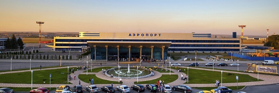
Your driver/guide will help you with your bags, and once your things are loaded in the waiting car/van, you’re off to Mt. Elbrus, about a 3.5 hour drive away.
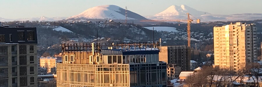
2) Leg 2 of the drive – Airport to Pyatigorsk – The first leg of this drive is relatively uneventful, as you start working your way past the historic city of Pyatigorsk towards the Caucasus mountain range. You’ll immediately notice a couple of smaller stand-alone mountain peaks 15 minutes from the airport. These are Mt. Beshtau (3 peaks clustered together) and Mt. Mashuk (with a red/white radio tower on top), both which have historic significance in Russian literature and Caucasus folklore.
If you’re hungry after your flight to MRV, Mineralni Vodi or Pyatigorsk would be the places to stop to grab a meal for the drive. Minernalni Vodi has a modern-looking mall “Vershina” right off the highway that has fast-food type restaurants you could stop by (bright blue lights, left side of the highway). Pyatigorsk has a McDonalds on the northern edge of the city, that is easy to stop at if you’re craving a taste of home.
From the airport, most drivers will skirt the eastern edge of Pyatigorsk, by the base of Mt. Mashuk, through the massive “Lira” market, which is a whole-sale market for small businesses and retailers from all across the North Caucasus. If you stop by the McDonalds in Pyatigorsk, you have the option of driving straight through the city as well. Be mindful of the time of day if you do this, as Pyatigorsk streets are pretty narrow, and at rush hour the traffic can get pretty backed-up.
You may see a police officer or two standing on the side of the road these first 45 minutes as you work your way past Pyatigorsk. This is normal in Russia; road cops stand on the side of the road, and with their black/white batons, can point at random at vehicles, for them to pull over and check that their documents are in order. This might be different from your home country, but is totally normal here, so nothing to worry about.
3) Leg 3 of the drive – Pyatigorsk to Baksan – Once you’ve circled past Pyatigorsk, you’ll pull up to a Truck Stop, where 18-wheelers must show their documents as well as what cargo they are transporting. There will be police officers at this stop, as you are leaving the Stavropol Region (i.e. Mineralni Vodi, Pyatigorsk) and entering Kabardino-Balkaria, where Mt. Elbrus is located. In the North Caucasus, this is normal, when you drive from one state/republic to another, to go through a security checkpoint. It’s very unlikely you would be stopped here, as they mainly check truckers’ documents/cargo.
Once you move through this area, you’ll drive past beautiful Lake Tambukan, which serves as a marker of the beginning of Kabardino-Balkaria. If the weather is nice, you will probably see a small group of cars and people sun-bathing and swimming to the left of the highway. Tambukan is famous throughout Russia for its black mud and the medicinal properties it carries.
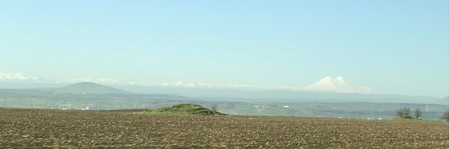
You’ll notice quickly that the landscape flattens out around you and opens into beautiful farm land for miles both ways. Kabardino-Balkaria is famous for its rich soil and one of the best agricultural regions in all of Russia. Depending on which month you drive through, you may see endless rows of budding apple trees, or breath-taking fields of giant sunflowers. On a clear day, the best part of this drive is being able to see Mt. Elbrus! Elbrus’s two gentle peaks can be visible (right side of the road) for about an hour of the drive from the Kabardian village Zalukokoazhe, up to the turn-off down the Baksan Valley.
If you read/speak Russian and can read the Cyrillic alphabet, you may also notice that store signs along the way are occasionally indecipherable. This is because the local language spoken in the flatlands of Kabardino-Balkaria is Kabardian, a Circassian language. Of course everyone speaks Russian, but the Kabardian people have lived on this land for centuries and still proudly carry on their traditions and language. If you’re lucky, you could pass a young man riding on horseback in traditional Kabardian warrior dress, complete with a sheep-skin papakha hat and a kinjal/dagger in its sheath!
About 40 minutes into Kabardino-Balkaria, you will pull up to the only federal road checkpoint on the way to Mt. Elbrus, the Malka stop. You can expect to see military personnel here with guns strapped on their shoulders. The reason for this is an extra measure of security after the chaotic years of the wars in Chechnya in the 1990s and early 2000s. Often larger vans will be asked to stop, and the soldiers will make sure there is no illegal contraband stored in the trunk. You may be asked to take your passport inside the control building. You’ll pass through a metal detector and then someone behind a desk will process your passport information. Again, standard procedure and nothing to be concerned about. Depending on the people on duty, they may even practice some English on you with a smile. Sometimes, if your car is stopped, the personnel on duty may briefly check the car trunk and send you on your way, and other times, you may not be stopped at all.
After this stop, it’s about 20-25 minutes longer to the Baksan traffic circle, where you’ll turn right towards Mt. Elbrus and start the climb into the Caucasus mountains!
4) Leg 4 of the drive – Baksan Valley – Once you’ve made the turn down the Baksan Valley, the Caucasus Mountains will start gradually rising on each side of the road as you drive deeper into this beautiful valley. It really is the highlight of the drive, as the scenery gets better and better the further you drive. You can expect to have to slow down multiple times for livestock roaming the roads: cows, sheep, even the occasional horse. Welcome to the rural Caucasus! Twenty minutes off the main highway, you’ll pass a large gray/silver statue of a Caucasus man; this is the village of Kendelen. At this point in your drive, the physical AND cultural make-up of the land changes, as hills that turn into rock walls start gradually rising up on each side of the road, and villages will begin gradually transitioning from Kabardian-speaking to Balkar-speaking, a Turkic-language group that has lived for hundreds of years at the base of the mountains.
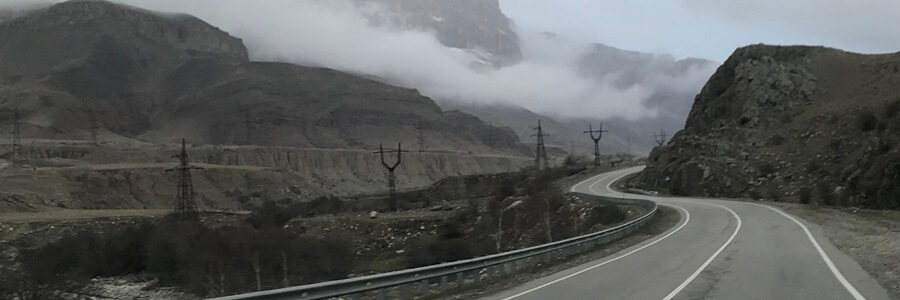
The topography on both sides of the road really is stunning, so soak in the view. After about 45-50 minutes on this road, you’ll drive into Tyrnyauz, which is a blast from the Soviet past. The apartment buildings and abandoned factories give you a clue that the city isn’t what it once was, a thriving tungsten mining town in the 1960s and 1970s. It is quite the sight to drive through this city and imagine what once was. If you have time after your Mt. Elbrus climb, it’s well worth your time to hire a local driver/guide to drive you up above the city to survey what is left of the mining town in the mountains; incredible views and history.
*** It was at this point on the Elbrus drive in 2011 that a group of terrorists shot and killed 3 Russian tourists from Moscow. This was essentially leftover residue from the conflicts in Chechnya. This is the only possible incident that Western travel warnings could be referring to when referencing safety along the route. The road to Elbrus was closed the rest of the 2011 climbing season as the Russian military secured the region from something like this happening again. Thankfully, this was the last incident of its kind along the Mt. Elbrus drive since that year (i.e. 2011). The region has increasingly grown safer with each year. Speaking personally, I remember multiple additional security checkpoints along the road in 2017, that aren’t there anymore. This is a very positive sign for the safety of the region.
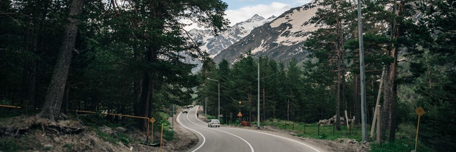
Once you’ve driven through Tyrnyauz, you will start the final “descent” to Mt. Elbrus, which is about 50-60 minutes away. At this point, you will start to notice the elevation change (your ears may start popping), as you continue to “rise” up the mountain roads towards Europe’s highest point. The roads also become much curvier at this point, as you wind your way up the narrowing mountain valley. The beautiful Caucasus forests start to become more prominent as well, especially on the left side of the highway. Quite the opposite of “dangerous”, this area is very serene and if you stop at the side of a road for some pictures, you’ll notice just how quiet it is in this corner of the Caucasus Mountains. By the way, there are multiple waterfalls in the 25-minute stretch after Tirnauz, several of which you can drive up close to and hike around. Well worth the stops!
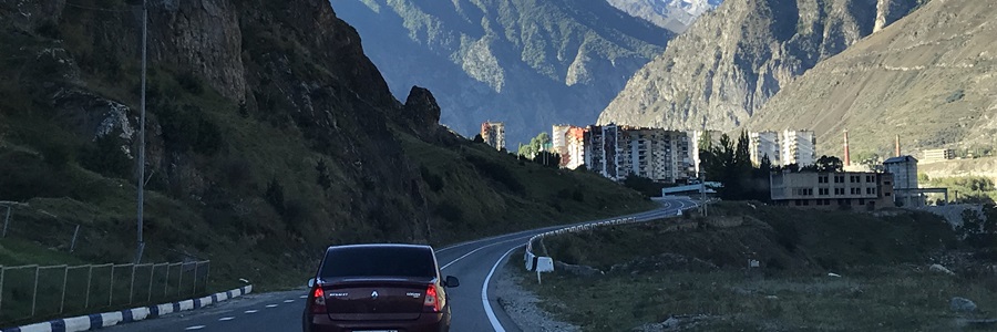
*** It’s in this stretch of road that there has been some occasional flooding in the past two decades. Heavy drainage down the mountain from glaciers melting and lakes overflowing, has resulted in small portions of the road being washed out twice in the past 20 years: 2018 and 2000. In 2018, there were sadly several local people whose car was washed away in these floods and they passed away (village of Elbrus). In 2000, the city of Tyrnyauz experienced a significant mudslide and flood down from the mountains as well.
5) Leg 5 of the drive – Lodging at the Base of Mt. Elbrus – About 20 minutes before you reach the base of Mt. Elbrus, you enter the final home-stretch of the drive. You’ll notice two things here. First, the woods create a “canopy” over the road that is very beautiful. Second, it’s obvious you’re getting close to the mountain, as hotels begin popping up on the left and right of the road. For those staying at Elbrus for a few days, there are essentially 4 hotel “zones”. You may have seen these different names online, and this is what they mean:
- Highway Hotels (villages such as Tegenekli, Elbrus, etc.) – There is a 10-15 minute stretch of wooded road with an abundance of hotels to stay at, including several nicer 4-star hotels.
- Cheget – This is on the left-side of the highway, about 10 minutes from the base of Mt. Elbrus. Cheget is actually a mountain, and has a small tourism infrastructure of hotels, restaurants, souvenir, and rental shops at the bottom. There are great 2-, 3-, and 4-star hotel options in Cheget. There’s a good chance you’ll be doing an acclimatization hike up Cheget Mountain.
- Terskol – Terskol is the last “residential” town before Mt. Elbrus, and immediately after Cheget on the highway. There are a couple hotels and restaurants here, as well as residential homes, apartment buildings, military barracks, grocery stores, and a mosque.
- Azau – Azau is the “settlement” of hotels/restaurants at the base of Mt. Elbrus. There are also multiple hotel options and restaurants here, as well as gear rental facilities and the famous cable cars/gondolas that take you up the mountain. The ski slopes of Mt. Elbrus lead right into Azau.
Azau is the end of your journey, at 7,500 feet above sea level! Three cable car/gondola rides away is Elbrus’s base camp at 13,000 feet.
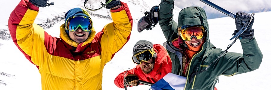
As you likely experienced, the drive to Mt. Elbrus is uneventful and quite beautiful. If you have time to explore, there are numerous lakes, waterfalls, and mountain gorges along the way that are well worth a visit. We hope you enjoyed your drive, and more importantly, successfully summited Mt. Elbrus! If you have further questions about this drive or are interested in visiting/climbing Mt. Elbrus yourself, please don’t hesitate to contact us at [email protected] . Best wishes and safe climbing!

