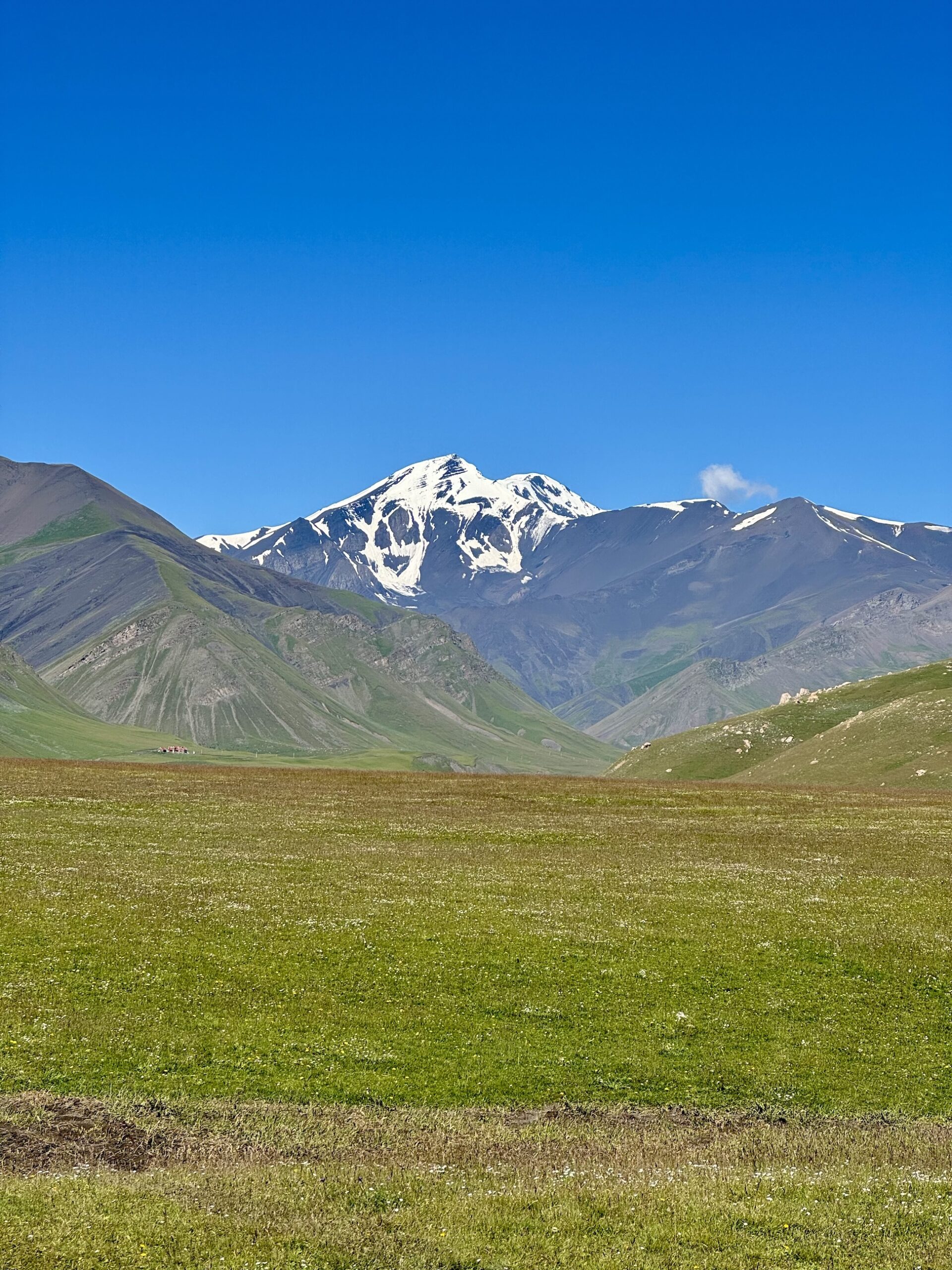
When it comes to recognizable mountain ranges in the world, most people have heard of the iconic Alps in Europe, the towering Himalayas in Asia, and the wide-ranging Rockies in the US & Canada. But the Caucasus Mountains? This is a tougher sell to your average Joe.
But the more you get to know this mountain range, the more you come to love it. We have been helping adventurers around the world summit beautiful Caucasus peaks since 2018: Mt. Elbrus in Russia (one of the 7 Summits & Europe’s highest peak at 5,642 meters), Mt. Kazbek in Georgia (5,054 meters), and Mt. Bazarduzu in Azerbaijan (4,466 meters).
Bazarduzu is by far the least-known of these three “famous” Caucasus peaks, and so allow us to help you make her acquaintance! Here are ten facts about Mt. Bazarduzu, Azerbaijan’s highest peak:
1) The Caucasus Mountains – Mt. Bazarduzu is in Azerbaijan, which is home to the eastern part of the Caucasus Mountain Range. The Caucasus range runs west to east from the Black Sea, cutting a direct line down the center of the range with the southern part of the mountains in Georgia and Azerbaijan and the northern part of the mountains in Russia. The Caucasus range flattens out in the east, i.e. in Azerbaijan, into the Caspian Sea. The lesser Caucasus range is in Armenia, and runs parallel to the greater Caucasus range as described above.
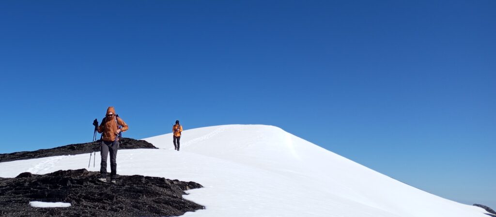
2) Non-technical Trek – Bazarduzu is Azerbaijan’s highest peak at 4,466 meters (14,652 feet). The next highest peak is Shahdag, at 4,243 meters (13,921 feet). No technical skills are required to climb Bazarduzu in the summer climbing season (i.e. no ropes, crampons, or ice axes). It would be considered trekking, not mountaineering.
3) What’s in a name? – The mountain has two names, depending on what language you are using. In Azerbaijani and Russian, Bazarduzu means “market mountain”, or “market square”, harking to historical memory of widespread marketplace trading on the Silk Road on the Shayalag plateau at the foot of the mountain. The native inhabitants to the wider Bazarduzu region (present-day NE Azerbaijan and southern Dagestan/Russia), the Lezgin people, refer to Bazarduzu as Кичӏен сув [kiˈtʃʼe suv].
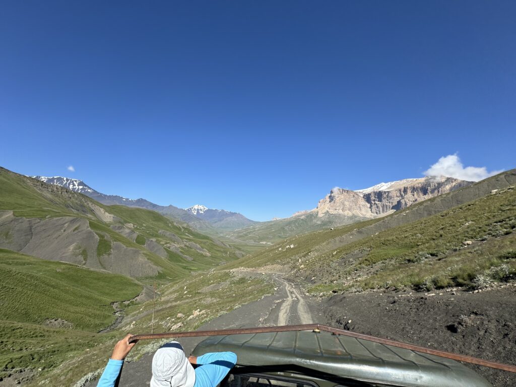
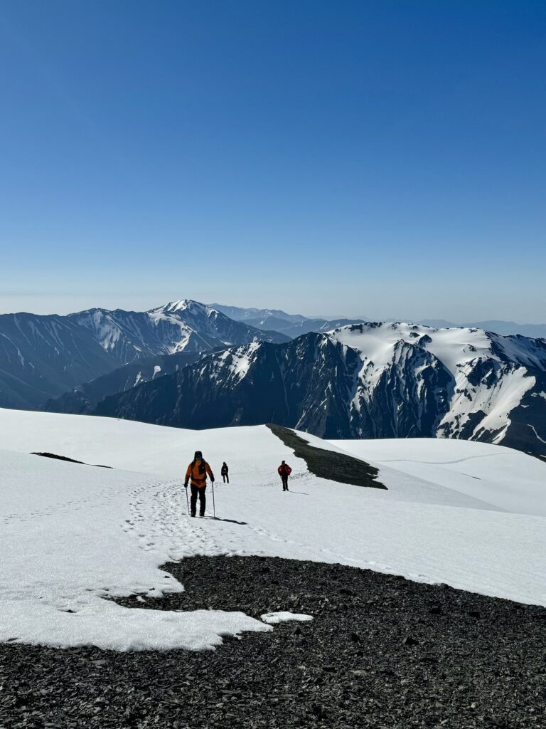
4) Two countries, two routes – Bazarduzu shares the international border with Azerbaijan & Dagestan, and can be climbed from both sides. The Russian ascent is not recommended for foreigners, with required border permits significantly more difficult to acquire and security checkpoints no small task to pass through successfully. The Azerbaijani route also requires government permission, but is much more well-traveled and permits are easy to acquire with a reputable local guiding company. We highly recommend the Azerbaijani route to ascend Mt. Bazarduzu.
5) First ascent(s) – There are two “first recorded ascents” of Mt. Bazarduzu. The more internationally recognized ascent is by British mountaineer & botanist GP Baker (or, George Percival Baker) and his friend George Yeld in 1890. Within Russian archives, one can read about military topographer Sergei (or Aleksei) Aleksandrov ascending Bazarduzu in 1847, four different times from May to October. Why Aleksandrov’s ascent is not as widely recognized as Baker’s & Yeld’s as the first ascent of this peak, is not for us to decide or debate about. But now you know both claims 🙂
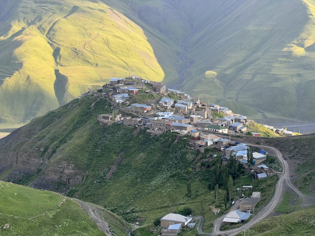
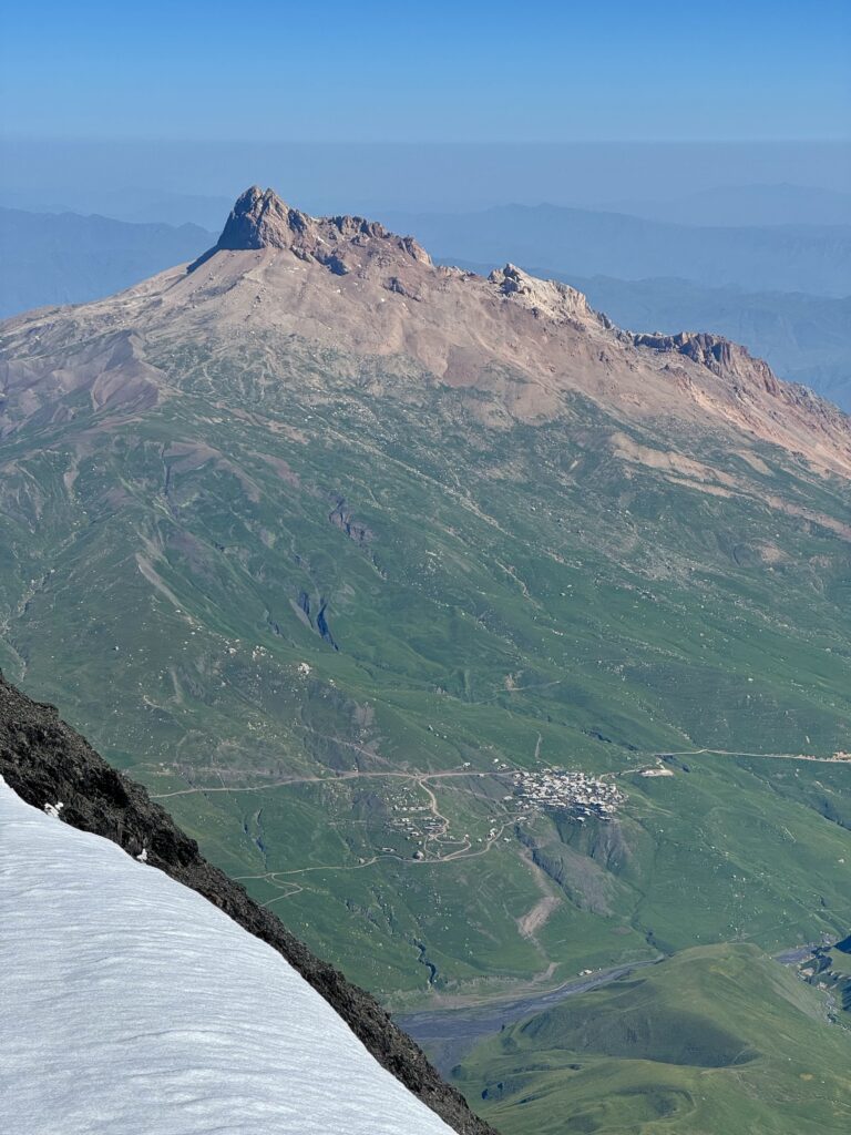
6) Khinalig – The road to Bazarduzu leads through Khinalig, a picturesque mountain village residing at 2,194 meters above sea level, or 7,200 feet. On an unrushed summit itinerary of Mt. Bazarduzu, you’ll spend your first & third nights here. Khinalig is one of Europe’s highest-elevation settlements and also labeled as a UNESCO World Heritage Site for its language, unique only to this village. The views are memorable and you’ll likely do an acclimatization hike to Kharibulbul Peak above the village (2783 m, or 9,130 ft.).
7) The route – The transport required to get to the top of Bazarduzu is quite diverse, including: off-road vehicle transport from Baku to Khinalig (4.5 hrs.~), acclimatization hike in Khinalig, Soviet-era Kamaz truck to drop-off point in border zone, 2 hr. Trek to base camp (3,200 m, or 10,498 ft.), acclimatization hike above base camp (3,400 m), summit-day ascent & descent. And then everything in reverse order. Packmules are potentially available to pay for in advance between drop-off point and base camp. Read more about the full blow-by-blow itinerary here.
8) Elevation Gain – Baku, where you’ll begin & end your Bazarduzu adventure, actually sits BELOW sea level at -28 meters (-92 feet). It is a literal ascent of almost 4,500 meters from touchdown at Heydar Aliev International Airport (GYD) to the peak of Bazarduzu (4,466 + 28 = 4,494 meters).
9) Mountain make-up – The upper layers of Mt. Bazarduzu are notable for their dark, slate-like rock that you ascend and descend down, otherwise known as scree. This can make for a fun, sliding descent, much quicker than your ascent!
10) View from the Top – From the summit of Mt. Bazarduzu, you can look down both into the southern portion of the Caucasus Mountains in Azerbaijan, as well as into the northern portion of the Caucasus Range in Dagestan (Russia), including a view of the village of Kurush, Europe’s highest continuously inhabited settlement at 2,560 meters (8,200 feet).
Are you ready to climb Mt. Bazarduzu yet? Spots are available to join public groups in Summer 2025, or you can book your own private trek for friends & family. Contact us now!

